
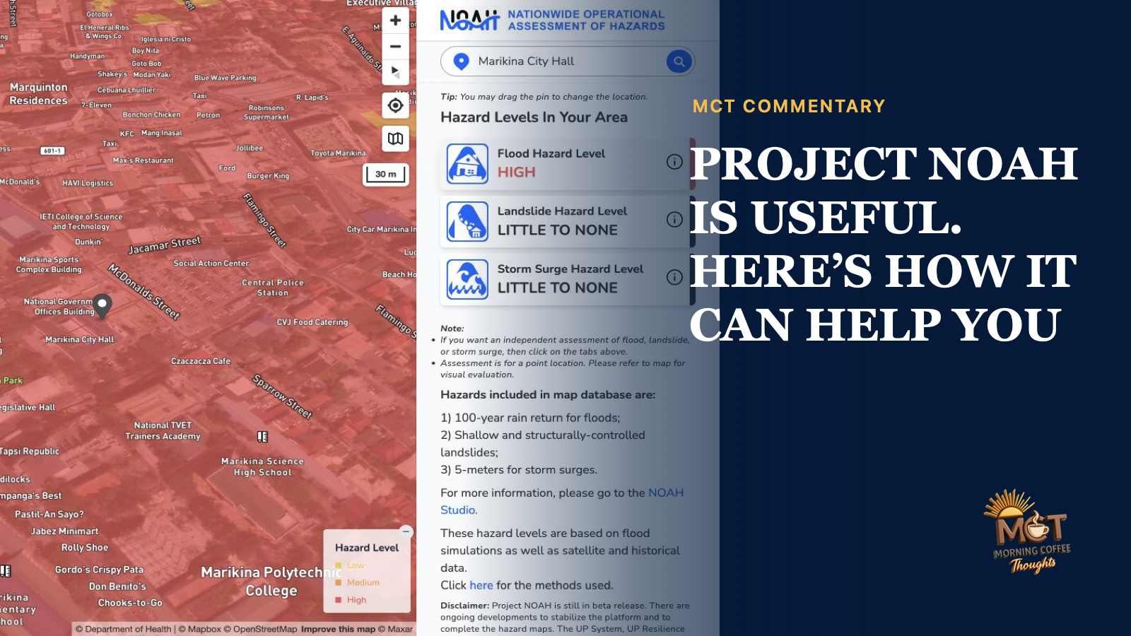
The government has just released ₱1 billion for Project NOAH. That caught my attention because NOAH is one of those public projects we remember whenever floodwater begins to rise, but many of us may not know what it can actually do today.
So I opened the website and tried to use it as a homeowner, a parent, a commuter, and a person looking at property. I wanted to answer a simple question: Can Project NOAH help me make a safer decision?
It can. The website is still in beta, so the current version should be understood as a useful platform that remains under development.
WHAT YOU CAN DO WITH PROJECT NOAH TODAY
The easiest place to begin is Know Your Hazards at noah.up.edu.ph. Search for an address or move the pin to a location. The page checks that point for three hazards:
- flood
- landslide
- storm surge
The results use simple labels such as little to none, low, medium, and high. The page also identifies nearby hospitals, health centers, police and fire stations, and schools.
I searched for Marikina City Hall. NOAH classified that point as a high flood hazard, with little to no indicated landslide or storm-surge hazard. The page also warned that the result applies only to the selected point and that the platform remains in beta.
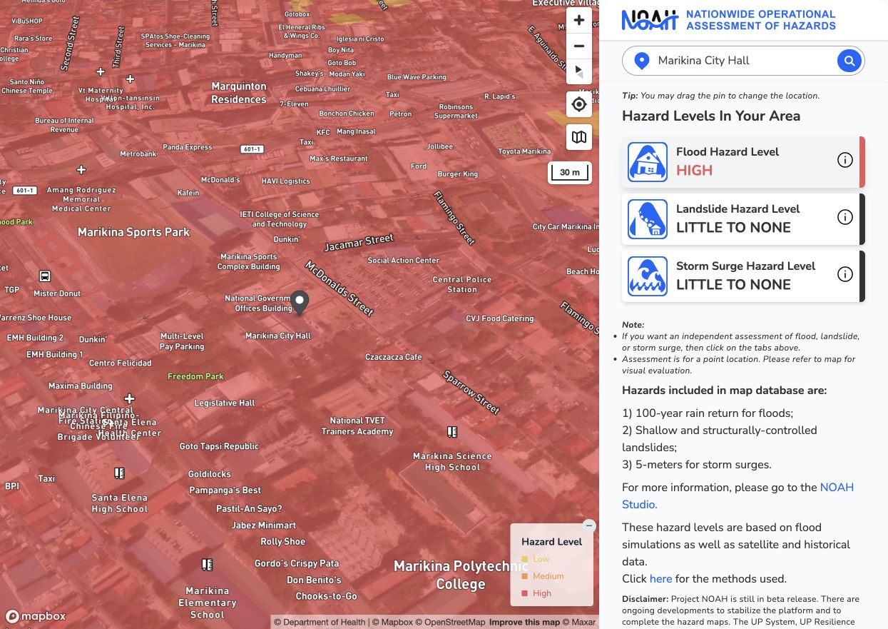
Project NOAH's point assessment for Marikina City Hall. The page classifies the selected point as a high flood hazard and warns users to examine the surrounding map.
Do not look only at your house. Check the road outside it, the bridge you use, the route to school or work, and the place where your family plans to evacuate. A house may sit outside a high-risk zone while its only exit road passes through one. A school listed as a nearby facility is not automatically an operating evacuation center. Confirm the official shelter and evacuation route with the local government.
Project NOAH also has a more detailed workspace called NOAH Studio. It can display flood, landslide, storm-surge, rainfall, typhoon, wind, temperature, satellite, volcano, critical-facility, and sensor layers over a wider area. This is more useful when comparing a barangay, road network, proposed site, or entire community.
Know Your Hazards answers, “What does the map indicate at this point?” NOAH Studio helps answer, “What is happening around it?”
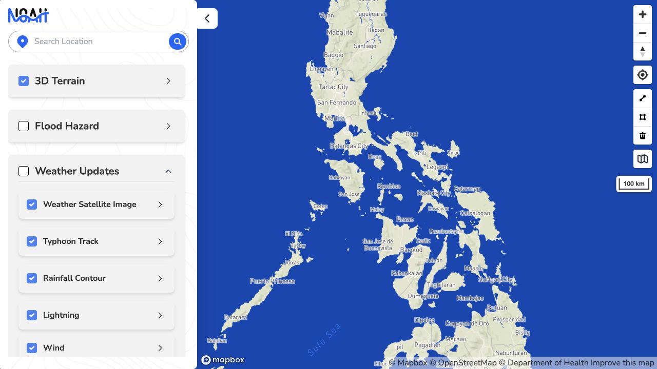
NOAH Studio provides a wider map and controls for weather, flood, landslide, storm-surge, temperature, facility, and sensor information.
The extra controls in Studio can overwhelm a first-time visitor. Start with the simple checker. Open Studio only when you need the wider picture.
Before a typhoon, check your home, your children’s school, your workplace, the home of an older relative, and the roads connecting them. Coastal families can compare the house, the road out, and the planned shelter against the storm-surge layer. People living near slopes can inspect the property and the route they would use to leave.
During heavy rain, NOAH’s rainfall and other weather layers can add context. But the site should not be treated as the sole authority during an emergency. PAGASA issues the official weather bulletins and warnings. Local governments decide when and where people should evacuate.
A hazard map is a model. It cannot see a drainage canal that was blocked this morning, a wall that has just collapsed, a damaged bridge, or water already rising outside your door. If local officials order an evacuation, do not wait for a map color to change.
USE IT BEFORE BUYING OR RENTING PROPERTY
Project NOAH can also help before you buy land, rent a house, or choose a place for a business.
Check the exact lot, then move the pin around it. Look at the entrance road, nearby waterways, slopes, bridges, coastline, and possible escape routes. Compare the map with what nearby residents and the local disaster office know about past flooding.
This is an additional check, not a safety certificate. The map may not reflect recent construction, altered drainage, land filling, or a newly blocked waterway. It does not replace a property inspection, technical assessment, or official government records, but it may reveal a risk worth investigating before anything is signed.
WHAT THE BETA VERSION CAN AND CANNOT DO
When I tested the public pages on August 25, the platform described its features as beta. The simple hazard checker said the site was still being stabilized and that some maps remained incomplete.
Most of the core hazard maps worked. Some other parts were still unavailable. In NOAH Studio, the flood and rain-gauge sensor feeds returned an “Unable to fetch data” message.
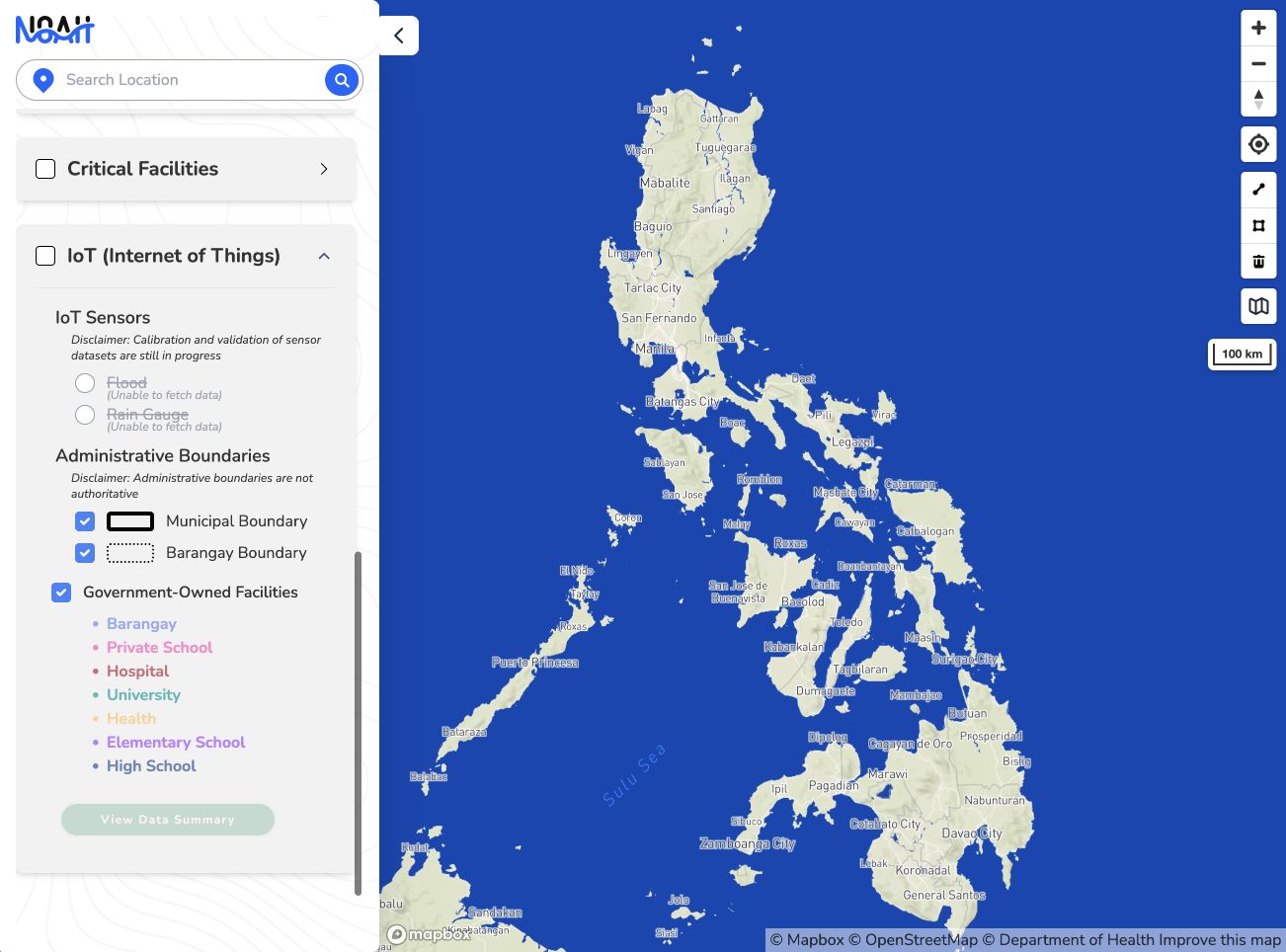
The flood and rain-gauge feeds were disabled during the review. The page said the data could not be fetched and that sensor calibration and validation were still in progress.
These limitations should not be treated as Project NOAH's final condition. The platform is still being stabilized. Clearer controls, visible update times, and working feeds should make the full version easier to understand and use, especially on a phone.
WHAT HAPPENED TO GOVERNMENT SUPPORT?
Project NOAH began under the Department of Science and Technology in 2012 after the devastation caused by Tropical Storm Sendong. It brought together research projects on floods, landslides, storm surges, weather, mapping, sensors, and public communication.
The DOST phase ended on February 28, 2017. DOST said the program had delivered its targets, received extensions, and reached its scheduled end. Its outputs were transferred to PAGASA, PHIVOLCS, NAMRIA, the Mines and Geosciences Bureau, and other agencies. That administrative explanation does not tell the whole story.
In January 2017, Project NOAH head Mahar Lagmay said 40 of its 80 personnel had lost their jobs because of budget cuts. A November 2016 follow-on proposal remained unanswered. DOST had also declined the continuation of Project ISAIAH and additional funding for other components. The record shows that DOST ended support for NOAH as the same integrated program, transferred its outputs, and said future research could be considered through new proposals.
A March 2016 DOST letter had already rejected an ISAIAH extension, although ₱24.5 million was later provided for some activities through February 2017. UP adopted Project NOAH before the DOST phase formally ended and established the NOAH Center under the UP Resilience Institute. PAGASA integrated NOAH maps, sensors, and risk tools into its systems, while the 2018 budget included ₱150 million for the institute.
The work survived, but the team lost trained people during the transition. Calling the original research program “completed” did not answer how its maps would be updated, how its systems would be maintained, or how its specialists would be retained.
WHAT THE NEW ₱1 BILLION IS SUPPOSED TO BUY
On August 24, 2026, the Department of Budget and Management announced the release of ₱1 billion to the UP System for Project NOAH. Of that amount, ₱935 million is for research services and ₱65 million is for general management and supervision.
UP says the money will support high-resolution mapping of major river basins, LiDAR drone surveys, the search for hidden waterways, hazard assessments, flood-management simulations, and nature-based solutions. It will also fund land-use planning work, technical personnel, equipment, artificial intelligence, and analytics.
Many people encounter artificial intelligence through chatbots, generated pictures, and other consumer tools. Project NOAH demonstrates how AI can also serve a critical public purpose. It can help researchers compare rainfall, terrain, rivers, drainage, land use, satellite observations, and historical flooding across many communities. It can run possible flood scenarios and help test whether a proposed flood-control project will reduce flooding or move the problem somewhere else.
This is where AI becomes practical. Disaster planning depends on time. A forecast or simulation has greater value when officials and families receive it early enough to move people, protect equipment, change a route, or reconsider a construction project. AI can shorten parts of the analysis, while scientists and engineers remain responsible for checking whether the results make sense.
The latest spending plan also includes mapping buried, altered, or undocumented waterways. A neighborhood may flood beside a channel that no longer appears clearly on the surface or in existing plans.
AI cannot repair weak or outdated data by itself. Lagmay has warned that the quality of the result depends on the quality of the information fed into the system. Scientists, engineers, local knowledge, field checks, and regularly updated maps remain essential.
WHAT THE PUBLIC SHOULD EXPECT IN RETURN
One billion pesos is substantial. The public should be able to see what improves because of it.
We should expect working and clearly dated data feeds, better mobile use, updated hazard maps, more detailed local forecasts, public explanations of uncertainty, and evidence that local governments are using the system. We should also expect transparency on the research, equipment, personnel, and projects funded by the allocation.
If NOAH will help assess flood-control proposals, the results should be understandable enough for citizens to see why a project is recommended, rejected, or redesigned. If hidden waterways are mapped, local governments should use that information in zoning, drainage, road, housing, and emergency plans.
Project NOAH already gives the public a way to look at danger before it reaches the doorstep. Bookmark the site and learn how to use it while the weather is calm. Check your home, the routes around it, and a property before buying. Bring questions from the map to your barangay and local disaster office.
I am looking forward to the full rollout of Project NOAH. The beta version already shows what the platform can offer. The new funding and AI-supported expansion could make its information faster, more detailed, and more useful to communities across the country.
SOURCES
- Project NOAH homepagehttps://noah.up.edu.ph/
- Project NOAH, Know Your Hazardshttps://noah.up.edu.ph/know-your-hazards
- Project NOAH Studiohttps://noah.up.edu.ph/noah-studio
- Project NOAH public data downloadshttps://drive.google.com/drive/folders/1ALE4-E9c-4AGjm1fqiPprWHrLUskeY9o
- UP adoption of Project NOAH, February 23, 2017https://up.edu.ph/up-to-continue-project-noah-2/
- UP creation of the NOAH Center, April 3, 2017https://up.edu.ph/announcements-3/
- DOST turnover of Project NOAH outputs, March 9, 2017https://pcieerd.dost.gov.ph/news/dost-turns-over-project-noah-outputs-to-pagasa-phivolcs-and-other-agencies/
- GMA News report on staff losses and the unanswered proposal, January 31, 2017https://www.gmanetwork.com/news/scitech/science/597736/maintain-personnel-despite-project-noah-shutdown-exec-appeals/story/
- UP account of the Resilience Institute and NOAH Centerhttps://up.edu.ph/resilience-begins-at-home/
- DBM release of ₱1 billion for Project NOAH, August 24, 2026https://www.dbm.gov.ph/index.php/management-2/4176-dbm-releases-p1-b-for-ai-powered-flood-forecasting-disaster-prevention-through-project-noah
- UP briefing on the ₱1-billion utilization plan, August 28, 2026https://up.edu.ph/upri-eyes-noah-expansion-with-%E2%82%B11-billion-budget/
- PNA report on hidden waterways and flood-model improvements, August 27, 2026https://www.pna.gov.ph/articles/1282812
- PNA report on the use of simulations to assess flood-control proposals, August 25, 2026https://www.pna.gov.ph/index.php/articles/1282646
- PAGASA national weather portalhttps://www.pagasa.dost.gov.ph/
- DepEd statement on dedicated evacuation centers and the use of schools, December 6, 2024https://www.deped.gov.ph/2024/12/06/deped-hails-passage-of-law-requiring-evacuation-centers-in-every-lgu/
- DHSUD guidance for property buyershttps://dhsud.gov.ph/news/follow-the-dream-to-avoid-being-scammed/
- The Philippine Star report on rejected continuation and component-funding requests, February 2, 2017https://www.philstar.com/business/science-and-environment/2017/02/02/1668037/govt-shuts-down-project-noah
- PhilSTAR Life reconstruction of the 2015–2017 funding and transition recordhttps://philstarlife.com/news-and-views/167331-whatever-happened-to-project-noah
- DBM FY 2018 annex listing ₱150 million for the UP Resilience Institutehttps://www.dbm.gov.ph/wp-content/uploads/Issuances/2018/National%20Budget%20Circular/ANNEX-B.pdf
- DOST 2017 performance report on PAGASA's integration of NOAH maps, sensors, and risk toolshttps://www.dost.gov.ph/phocadownload/Downloads/Annual_Reports/Performance_Reports/2017_DOST_performance_report.pdf