Lacson, Marcoleta, and the Real Story of the Kalayaan Group of Islands
I started with one simple question: if even Lacson and Marcoleta can’t agree on the origin story of the Kalayaan Group of Islands, what actually happened out there? I don’t claim to know the true history, but I wanted to find out for myself by going back to the cases, treaties, maps, and timelines. This piece is my attempt to lay out what I found—where Lacson leans on the Cloma discovery myth, where Marcoleta is inconveniently right, and where both of them bump up against the harder facts of how Kalayaan became ours to defend.
14 min read
We need to say this upfront, kasi mahalaga: the Kalayaan Island Group (KIG) is ours to defend.
Not because Tomas Cloma “discovered” empty islands in 1956, but because for decades the Philippine state has lived there, governed there, and held the line there.
This piece is a byproduct of research, caffeine, and curiosity.
I’m not a historian, just a student of history trying to trace where Kalayaan really came from based on the documents I could find.
If I missed something or read a source poorly, I’m happy to be corrected—this is an honest attempt to make sense of the receipts we have, not a final verdict.
As I went deeper into the archives and rewatched the hearings, one thing kept bothering me: the origin story being debated on the Senate floor looks wrong, but the claim itself is not.
The danger is that the fake story is so weak, it makes the real legal grounds easier to attack. That’s what this piece is about.
If you stay with me, we’ll walk through three things: how the discovery myth grew, what the documents actually show, and how dropping that myth makes our West Philippine Sea strategy stronger, not weaker.
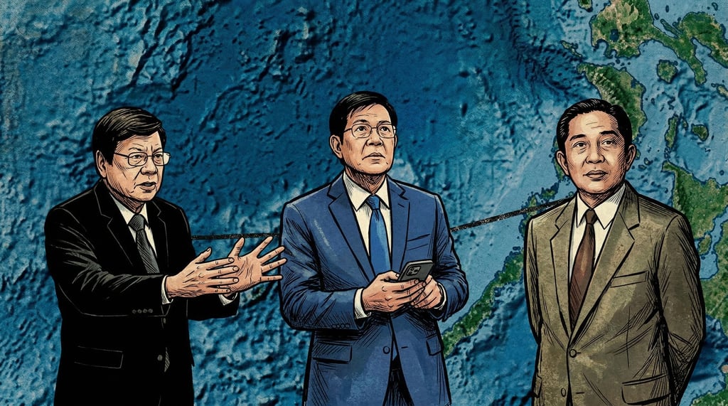
The latest proof that our own narrative is cracking came in a February 2026 hearing, when the Senate turned into a history classroom and a propaganda test at the same time.
On one side, Panfilo Lacson was defending the familiar story many Filipinos grew up with: Tomas Cloma “discovered” empty islands in the West Philippine Sea, claimed them under res nullius (Latin, "the thing belongs to no one."), then donated them to the Republic, supposedly wrapped up neatly by Marcos Sr. through Presidential Decree 1596 (PD 1596) and later validated by the 2016 arbitral award.
On the other side, Rodante Marcoleta was calling that story a distortion.
He argued that by 1956, the Spratlys were already discovered, mapped, claimed, and occupied by Vietnam, Britain, France, Japan, and China, and that the Philippine state itself had distanced from Cloma’s adventure at the time.
He kept returning to one idea: our modern claim stands on effective control and state administration, not on a private “discovery” myth.
If you follow Philippine politics, it’s jarring to hear that from someone like Marcoleta. I’ve criticized his positions before, and nothing in this piece changes that. But if we’re honest about the documents I've read, this is the moment where the myth starts to unravel.
WHY THE DISCOVERY STORY NEVER REALLY WORKED
The discovery story sounds simple. You imagine an empty sea, a brave Filipino pioneer, a flag on an unclaimed sandbar.
According to my research, by the early 20th century—especially after cases like Island of Palmas—international law no longer treated bare discovery as enough to create full sovereignty.
Under modern doctrine, discovery only gives what Max Huber in the Island of Palmas case called an inchoate title: a half-formed claim that doesn’t mature into full sovereignty unless a state follows it up with continuous, peaceful, effective exercise of authority.
Planting a flag or writing a note to “the whole world” is not enough; you need administration, governance, and presence.
Huber also rejected the idea that islands belong to whoever is closest, so “malapit sa Palawan” by itself does not create ownership.
That’s already a problem for the way we talk about Cloma. He was a private citizen, not a state.
Even if he had stumbled on something new, discovery alone would not establish perfect title, and he never turned Freedomland (the name Cloama gave his claimed 'free territory') into a functioning, effectively governed territory.
The 2016 South China Sea arbitral award doesn’t rescue the myth either, at least based on how I read it.
The tribunal was clear that it had no jurisdiction to rule on territorial sovereignty; it dealt with maritime entitlements under the United Nations Convention on the Law of the Sea (UNCLOS) and the status of features as rocks, islands, or low-tide elevations.
When it mentions Cloma at all, it’s as a businessman trying to devise a commercial scheme who never actually settled the islands or drew economic benefit from them, not as a legal architect of Philippine sovereignty.
So even before we open the archives, the legal scaffolding of the “discovery and donation” story looks shaky. The law cares about effective control, not about romantic origin stories.
THE LONG HISTORY BEFORE CLOMA EVEN ARRIVED
Once you look at the timeline, the idea that the Spratlys were “undiscovered” in 1956 collapses fast.
Long before Cloma was born, regional powers already treated these waters as part of their administrative and strategic universe.
Vietnamese chronicles under the Nguyen dynasty describe offshore administration, with Emperor Gia Long formally annexing the Paracel Islands in 1816.
By 1833, Emperor Minh Mang had officials planting trees on the islands for navigation safety and, a year later, sending a small garrison to run detailed mapping and surveys.
In 1837, Jean-Louis Taberd published a Note on the Geography of Cochinchina (roughly today’s southern Vietnam), documenting how Vietnamese emperors dispatched personnel to map and garrison offshore islands.
Those records suggest that regional states weren’t guessing where these features were; they were administering, naming, and managing them more than a century before Cloma’s expedition.
The very word “Spratly” comes from British activity. In 1843, Captain Richard Spratly recorded features that later carried his name on British charts.
By 1877 and 1889, British authorities in Labuan were formally granting guano leases over specific features, authorizing British subjects and an American citizen to raise the British flag and mine guano, which is a concrete assertion of jurisdiction, not a passing curiosity.
France then moved from maps to formal annexation. In 1930 it claimed sovereignty over the Spratly Islands, and by 26 July 1933 it announced annexation in the Journal Officiel, folding them into French Indochina’s Cochinchina region (roughly today’s southern Vietnam, including Bà Rịa).
The French Navy built infrastructure, including a weather station on Itu Aba in 1938, with code 48919 and data listed as coming from Cochinchina, backed by militia on the ground.
Japan did not treat the area as empty either. In 1939 it invaded the Spratlys, drove out the French, renamed the group Shinnan Shoto, and attached it to Takao Prefecture in Japanese-occupied Taiwan (covering what is now Kaohsiung and Pingtung).
When Japan surrendered in 1945, the Allies ordered Japanese forces in the area to surrender to the Republic of China (ROC, now based in Taiwan), which in 1946 sailed to the Spratlys, took the surrender, and set up a garrison on Itu Aba (Taiping Island, now held by Taiwan), complete with sovereignty markers.
France did not simply walk away in silence after the war. In October 1946, it sent the battleship Chevreud back to the Spratlys to reassert colonial interests, with the crew installing a sovereignty stele on Itu Aba as a physical marker of French claims in the post-war scramble.
At the same time, the newly formed People’s Republic of China (PRC, on the mainland) adopted the nine-dash line and asserted its own claims over the Spratlys and Paracels (which it calls Nansha and Xisha).
The 1951 San Francisco Peace Treaty then added legal fog but not historical silence: Article 2(f) made Japan renounce all “right, title, and claim” to the Spratly and Paracel Islands but deliberately did not name a successor state, after the US and UK rejected a Soviet amendment that would have explicitly awarded them to the PRC.
That omission created room for confusion. It did not erase Vietnamese records, British leases, French annexation, Japanese military rule, or Chinese garrisons.
By the time Cloma’s ship left Manila, the sea was already crowded with flags, treaties, and bases.
CLOMA’S GAMBIT AND THE WORLD’S ANSWER
Tomas Cloma was not a cartoon villain. He was a Boholano lawyer, a fishing magnate, and founder of the Philippine Maritime Institute (PMI), who saw opportunity in that legal fog after the San Francisco Treaty.
He wanted to expand his fishing operations, build a cannery, and tap guano deposits, and he believed the ambiguous language about Japan’s renunciation meant the islands had become res nullius again.
On March 1, 1956, he hosted a farewell dinner in Manila, attended by officials including Vice President and Foreign Secretary Carlos P. Garcia.
On March 15, the training ship PMI-IV, commanded by his brother Filemon and crewed by forty men, reached the Spratlys; after a 38-day survey, they held a ceremony on May 11 claiming 33 features.
Four days later, Cloma issued his “Notice to the Whole World”, declaring absolute ownership over the “Free Territory of Freedomland” or Kalayaan, and on May 21 he formally informed Garcia that he had occupied land “belonging to no one” as a private citizen outside Philippine jurisdiction.
By July 6, Cloma had gone further, declaring a separate government for Freedomland with its capital on Flat (Patag) Island.
If the area had genuinely been res nullius, this might have become a strange footnote in maritime history.
Instead, the reaction was immediate and hostile, precisely because other states viewed the area as already claimed.
Taiwan’s ROC government summoned the Philippine ambassador to demand explanations, then in June 1956 intercepted and disarmed a Filipino fishing vessel in the area.
By July 11 it had dispatched a naval task force to re-garrison Itu Aba (Taiping Island), landed supplies, set up a radio tower, and physically blocked Cloma from the largest and most strategic feature.
When Cloma stole an ROC flag from Itu Aba, he ended up having to apologize and return it to the Chinese embassy in Manila.
The PRC’s foreign ministry issued a statement on May 29, 1956, reaffirming China’s “indisputable” sovereignty over the Nansha (Spratly) Islands and denouncing the terra nullius argument as entirely groundless.
France sent a formal note through its chargé d’affaires on June 7, reminding Manila of its 1933 annexation, and backed this with the deployment of the warship Dumont d’Urville.
South Vietnam, on June 1, 1956, issued its own communique reasserting historical sovereignty and signalling intent to occupy features.
The speed, anger, and military moves tell you everything you need to know.
The world did not see an empty sea that a Filipino adventurer had just discovered.
They saw a contested archipelago where someone was trying to exploit a legal opening and got slapped back.
HOW THE PHILIPPINE STATE QUIETLY REWROTE THE STORY
Inside Malacañang, Cloma’s stunt was not viewed as a patriotic masterstroke.
Ramon Magsaysay’s administration initially saw it as a potential trigger for conflict with Taiwan and China over a private micronation no one asked for.
Military and foreign policy advisers opposed adopting his claim, and the government treated Freedomland more like a dangerous sideshow than a foundation for state policy.
Carlos P. Garcia sat at an uncomfortable intersection. As a Boholano ally and beneficiary of the Cloma family’s political support, he sympathized with Tomas privately and suggested that the Philippines should consider laying claim.
But as Foreign Secretary, he had to face furious embassies and formally state that Cloma was acting only as a private citizen and not on behalf of the Republic.
To protect Philippine interests without endorsing the res nullius claim, Garcia floated a trusteeship theory: that, after Japan’s renunciation, the islands were under the de facto trusteeship of the Allied Powers, and the Philippines, as an Allied country in geographic proximity, could exploit them economically and prevent hostile occupation.
That stance is crucial: it shows the state did not, at that time, treat Cloma's 'discovery' as a legal act of annexation for the Philippines, and some in Malacañang even joked that his micronation sounded like comic opera more than statecraft.
Over the next decade, that tone changed. As the Cold War intensified and potential oil and gas reserves in the South China Sea came into focus, Manila stopped treating Kalayaan as a punchline and started seeing it as an existential flank.
By 1968, the Armed Forces of the Philippines (AFP) were already moving to occupy several unoccupied features near Palawan to secure the western side of the archipelago.
Then Marcos did what Marcos usually did: centralized and coerced. In 1974, his government had Cloma arrested and detained in Camp Crame in Quezon City on charges of usurpation of authority, partly because he allowed people to call him “Admiral,” a title reserved for actual flag officers.
While in detention, Cloma was pressured into signing a Deed of Assignment and Waiver of Rights, surrendering all his claims over Freedomland to the government for a symbolic one peso, and was released thereafter.
Four years later, on June 11, 1978, Marcos issued Presidential Decree 1596 (PD 1596).
PD 1596 did not read like a love letter to Cloma.
Its preamble justified Philippine sovereignty over the newly defined Kalayaan Island Group by citing security and economic survival, the fact that much of the area is part of the Philippine continental margin, alleged abandonment of competing claims, and—most importantly—“effective occupation and control established in accordance with international law” and other legal, historical, and equitable grounds.
The decree also drew coordinates that, as many legal commentators have pointed out, effectively exclude Spratly Island itself—the feature with the densest cluster of historical foreign claims and the name of the wider archipelago.
By doing that, it built a domestic legal object—Kalayaan Island Group—distinct from the broader “Spratly Islands” fight.
It created a municipality of Kalayaan under Palawan, with administration placed under the Secretary of National Defense.
In practice, our claim today is expressed through Pag-asa Island (the main inhabited island of Kalayaan), military detachments on other features including BRP Sierra Madre on Ayungin Shoal, and an actual municipal government that files budgets and meets basic administrative functions.
None of that leans on a romantic story about discovery. All of it leans on presence, administration, and control.
Kalayaan is ours to defend because we are actually there and we have been there for decades.
That’s the base of the triangle under the clear statement we planted at the top.
THE ONE THING MARCOLETA GOT RIGHT—AND WHAT HE’S DOING WITH IT
If you stack the documents, one narrow conclusion is hard to escape.
According to my research, Cloma did not “discover” an empty Kalayaan Island Group in 1956. The islands had been known, mapped, leased, annexed, invaded, and garrisoned by other states for over a century, and modern international law would not have granted a private discovery claim full sovereign title anyway.
On that specific historical and legal point, what Marcoleta said in the hearing—that treating Cloma as a discoverer is distortion, and that our claim rests on effective control and administration—lines up with Island of Palmas, with pre-1956 history, and with PD 1596’s own language.
That’s why the 2026 exchange with Brig. Gen. Alexander Gigantone bothered me so much.
When Marcoleta pressed him on whether the AFP’s Command and General Staff Course (CGSC) was still teaching officers that Cloma “discovered” Kalayaan, it stopped being an abstract history debate and turned into a live question about what story we’re wiring into the minds of the people expected to defend these waters.
I’m not thrilled to type that sentence. But if I’m going to ask the AFP and Filipino readers to update their understanding, I can’t pretend the evidence points elsewhere. The story can’t stop there, though. Because the question is never just “who is technically right on one fact,” but “how are they using that fact?”
In other venues, Marcoleta has floated the idea of simply “giving up” the Kalayaan Island Group because it supposedly sits outside our 200-nautical-mile Exclusive Economic Zone (EEZ), as if UNCLOS distance alone erases sovereignty built on effective occupation and municipal governance.
His line in that hearing was blunt: “Ano ba talaga ang pagpapatayan natin? We will offer our lives and the lives of our children to die for it for something that is not even within our EEZ. Ang gawin natin po para madali, i-give up natin ang Kalayaan Island Group.”
Maritime law experts like Antonio Carpio and Jay Batongbacal have already dismantled that line, stressing that the status of land features is governed by general international law and effective control, and warning that arguments like his nudge Filipinos toward surrendering something already theirs by right.
He has also tried to reduce the work of people like Justice Carpio, Commodore Jay Tarriela, and Batongbacal to mere “satsat,” attacking the same experts who helped win and defend the 2016 award and who keep explaining these issues to the public.
Every time you call that “satsat,” you are telling ordinary Filipinos that serious legal and strategic work is just noise.
That weakens us from the inside, long before any Chinese coast guard ship shows up.
Then there’s the origin of some of his talking points. In a privilege speech, Lacson laid out how certain lines in Marcoleta’s arguments about KIG and Cloma track language on the PRC Ministry of Foreign Affairs website, and warned about narratives imported straight from Beijing being echoed in our own Senate.
After a meeting with Chinese Ambassador Huang Xilian, Marcoleta went to the floor to relay Beijing’s complaint about being cast as the kontrabida in our own maritime story.
Pro-China outlets like Asian Century Journal, already flagged by security analysts for repeating Chinese Communist Party narratives, have treated his minority reports like hero material.
So yes, on Cloma’s “discovery,” he stumbled into the right side of the historical record.
But he’s not using that truth to harden our legal footing on effective control.
He’s using it while pushing other lines that soften the public for giving up, discredit our own defenders, and normalize Beijing’s script inside our discourse.
That’s a problem I can’t ignore. And here, I'd understand why people keep referring to him as a "Tsinator."
THE REAL RECEIPTS: WHY KALAYAAN IS LEGALLY OURS
Up to this point, I’ve been arguing mostly by subtraction—showing why the Cloma discovery story doesn’t hold up, and why effective control explains more of our position than any 1956 adventure.
But if we’re going to say “Kalayaan is ours to defend,” we should also put the positive receipts on the table.
If we want a real origin story, we don’t need to start in 1956.
We can look at the 1734 Murillo Velarde map, often called the “Mother of all Philippine Maps.”
Drawn in Manila by Father Pedro Murillo Velarde with Filipino artisans, it already shows the Spratlys as Los Bajos de Paragua (shoals off Palawan) and Scarborough Shoal as Panacot (the old name for what we now call Bajo de Masinloc or Panatag)—centuries before Cloma even bought a boat.
Then there’s the part people tend to forget when they talk about colonial-era treaties. We always hear about the 1898 Treaty of Paris and how the Spratlys supposedly sit outside those famous lines.
What rarely gets mentioned in the same breath is the 1900 Treaty of Washington, where Spain explicitly relinquished to the United States “any and all islands belonging to the Philippine Archipelago” lying outside the original Paris lines. Under the Filipino reading of that treaty, this sweeps those outlying islands into the legal definition of the archipelago.
In international law, there’s also that mouthful of a rule called uti possidetis juris.
In plain English, it means that when a colony becomes an independent state, the old colonial borders get frozen in place and must be respected by everyone else, unless neighbors agree to change them.
So if those colonial-era treaties and maps treated far-flung shoals and reefs as part of the Philippine archipelago, our modern Republic inherits that perimeter by default.
Fast forward to UNCLOS and the 2016 arbitral award.
UNCLOS runs on a simple but powerful idea: land dominates the sea, meaning rights over waters are generated by lawful control over land features.
Because, according to my research, we have a solid chain of colonial-era inclusion, post-colonial succession, and decades of effective occupation over specific features, we have a serious claim to the waters around them—and the 2016 award slammed the door on China’s nine-dash line as a legally valid excuse to erase those rights.
When you stack up the 1734 map, the 1900 Treaty of Washington, colonial succession rules, continuous state administration, and a major win at The Hague, the legal arsenal behind Kalayaan gets very heavy.
We don’t need to lean on a fragile 1956 discovery myth to justify defending it. We have the receipts.
WHY WE NEED TO LET THE MYTH GO ANYWAY
We’re in a strange place as a country.
We keep defending a discovery myth the documents don’t support, while our actual legal strength—effective occupation, municipal governance, the UNCLOS framework—is sitting right there, underused.
We get anxious when someone we dislike points out that the myth is false, even when the archives and jurisprudence agree. But clinging to a weak story doesn’t protect us.
It makes us easier to embarrass in international debates, because rival states can point to French annexations, Japanese bases, and Chinese garrisons and say, “How can you claim discovery in 1956?”
It gives people repeating Beijing’s talking points a chance to sound “more accurate” than our own defenders on this one slice of history. We don’t need that.
We can say: and again, this is from my research, Cloma didn’t discover Kalayaan; the sea was never empty; discovery is not our legal foundation.
Our claim stands on decades of effective control, on PD 1596’s text, on Pag-asa’s community, and on the law of the sea—not on a private businessman’s misunderstood reading of the San Francisco Treaty.
Letting go of the myth is not surrendering to China or to any politician. It’s tightening our own argument, cleaning up our own house, and making sure the story we teach our officers and our kids can survive contact with reality.
Kalayaan is ours to defend, just not for the reasons we were taught.
Everything I’ve laid out here is based on the sources I could access and how I understand them today. If new evidence or better arguments surface, I reserve the right to change my mind—and I hope we all do.
"The harder question now is simple: if we already know the discovery story is broken, are we brave enough to fix the version written in our manuals and classrooms — regardless of who is asking?"
And Marcoleta? He may have stumbled onto one argument that actually holds up. But I don't think he found it on purpose — and I'm even less convinced he's raising it for the right reasons. Because if you've watched his pattern long enough, you already know where his loyalties are. And they are not with this country.
SOURCES:
https://docs.google.com/document/d/1Uo3R0BEOoKBaOfau4m2S4FstC4qgW7dRwwWfK5AQikI/edit?usp=sharing
Contact us
subscribe to morning coffee thoughts today!
inquiry@morningcoffeethoughts.org
© 2024. All rights reserved.